How alerts work
Earthquake notification vs early warning: what your phone can and cannot do
An earthquake cannot be predicted, but once it starts it can be outrun. Early-warning systems exploit the few seconds between the first seismic wave to arrive and the wave that does the damage.
An earthquake radiates fast P-waves (roughly 6 km/s in the crust) ahead of the slower, more destructive S-waves and surface waves (roughly 3.5 km/s). An electronic message outruns both. A network that detects the P-wave near the epicenter can therefore alert places farther away before strong shaking reaches them. Near the epicenter there is no time to do this — that area is the blind zone. Japan, Mexico, Taiwan, South Korea, Israel and the US West Coast run public systems; Spain and most of Europe do not.
Why an alert can outrun the shaking
A fault does not release its energy as a single pulse. It radiates several kinds of seismic wave, and they travel at different speeds through rock. The P-wave (primary, or compressional) is the fastest and arrives first. It is usually felt as a sharp jolt or a bang rather than as damaging motion. Behind it come the S-wave (secondary, or shear) and then the surface waves, which carry most of the energy that breaks buildings.
The USGS gives the P-wave a speed of about 3.7 miles per second and the S-wave about 2.5 miles per second. Standard crustal values are close to 6 km/s for P and 3.5 km/s for S; the exact numbers vary with rock type, depth and path, so treat every figure on this page as an approximation rather than a specification.
The third speed is the one that makes early warning possible. Once seismometers near the epicenter have recorded the P-wave, the alert travels as an electronic message over fiber and radio at a substantial fraction of the speed of light — hundreds of thousands of kilometers per second. Compared with 3.5 km/s, that is effectively instantaneous. The warning does not race the earthquake through the ground; it takes a shortcut.
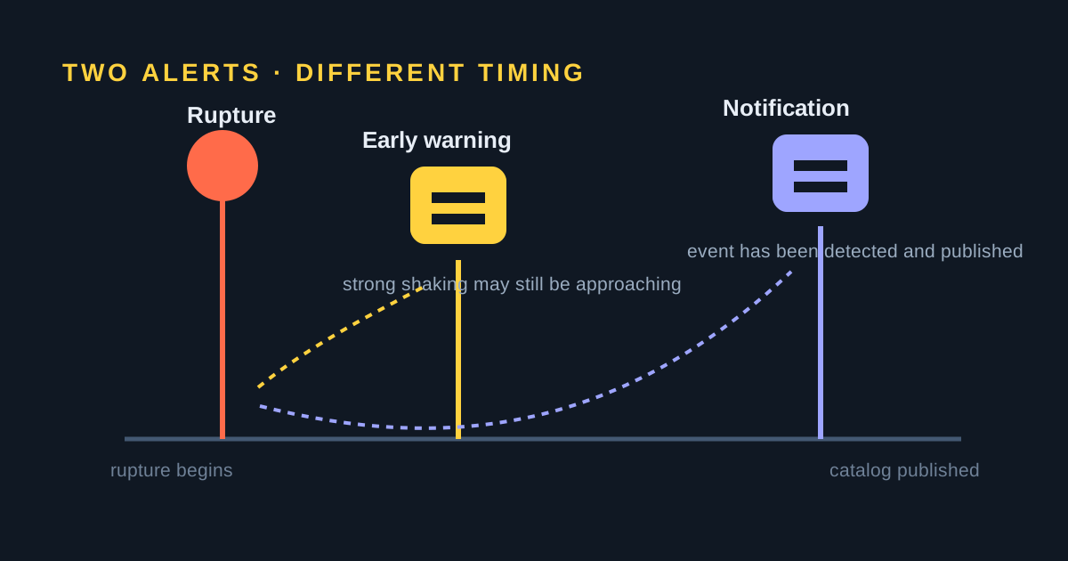
So the sequence is always the same: rupture begins → nearby stations record the P-wave → a processing center estimates location and magnitude from those first seconds of data → an alert is pushed to phones, broadcasters and automated systems → the S-wave and surface waves arrive. Early warning is not a forecast. The earthquake is already happening; the system is simply faster than the wave.
How much warning that buys you
The arithmetic is worth doing yourself, because it explains every limitation that follows. At a distance d from the epicenter, the P-wave arrives after d ÷ 6 seconds and the S-wave after d ÷ 3.5 seconds. The gap between them is:
d ÷ 3.5 − d ÷ 6 ≈ 0.12 × d seconds — about 1.2 seconds of headroom for every 10 km of distance.
That headroom is not all yours. The system must record the P-wave at enough stations to be confident it is an earthquake, estimate its size, decide whether it clears the alerting threshold, and deliver the message. The illustration below assumes 5 seconds for all of that, which is a reasonable round number for a dense modern network. Your usable warning is therefore roughly 0.12 × d − 5 seconds.
| Distance from epicenter | P-wave arrives | S-wave arrives | Alert delivered | Warning you get |
|---|---|---|---|---|
| 25 km | 4.2 s | 7.1 s | 9.2 s | None — shaking first |
| 50 km | 8.3 s | 14.3 s | 13.3 s | ~1 s |
| 100 km | 16.7 s | 28.6 s | 21.7 s | ~7 s |
| 150 km | 25.0 s | 42.9 s | 30.0 s | ~13 s |
| 200 km | 33.3 s | 57.1 s | 38.3 s | ~19 s |
| 300 km | 50.0 s | 85.7 s | 55.0 s | ~31 s |
Check one row: at 100 km the S-wave needs 100 ÷ 3.5 = 28.6 s to arrive, while the P-wave needs 100 ÷ 6 = 16.7 s. Add the 5-second processing and delivery allowance and the alert lands at 21.7 s — about seven seconds of warning. Set the same expression to zero and you get the break-even distance: 5 ÷ 0.12 ≈ 42 km. Inside that, this simplified model gives no warning at all.
Three things are deliberately left out. Depth matters: for a deep earthquake the true travel path is longer than the map distance, which slightly increases the gap. The rupture is a moving surface, not a point, so a long fault keeps radiating waves after the alert has gone out. And the strongest shaking is not always carried by the S-wave — surface waves are slower still and can dominate at distance. Using a faster S-wave of 4 km/s instead of 3.5 km/s shrinks every gap in the table by about a third, which is a fair reminder of how sensitive these numbers are to assumptions.
The blind zone: the limitation that matters most
The area around the epicenter that cannot be warned in time is called the blind zone. It exists because every step — detection, magnitude estimation, transmission, and the human or machine response at the other end — costs time, and during that time the damaging waves are already spreading. The USGS puts it plainly: current network and communication limits produce a zone of roughly 25 km (15 miles) radius around the epicenter for which alerts are not possible.
This is the cruel part of the physics. The USGS notes that injuries and fatalities occur mostly where shaking reaches Modified Mercalli Intensity VII or higher — and for a moderate crustal earthquake, that is largely inside the blind zone. The people who need the warning most are the ones least likely to get it, while people far enough away to be safe get the most warning. For onshore crustal earthquakes in California the USGS expects roughly ten seconds or more of warning in lightly shaken areas, under ten seconds where shaking is moderate, and little or none in the heavily damaged area.
Two situations improve the picture. Offshore subduction earthquakes rupture far from the coast, so coastal cities sit well outside the blind zone — a large part of the value of the systems in Japan and Mexico. And deep earthquakes, such as those that shake Bucharest from the Vrancea zone, put extra kilometers of travel path between the source and the city. Shallow local faults are the hard case: an earthquake directly under a city is exactly the one early warning cannot help with. That is worth remembering when reading about California earthquakes, where many damaging events are shallow and close to populated areas.
What the alert levels mean in practice
Public systems do not send one undifferentiated alarm. They separate a mild heads-up from a message that demands immediate action, and they use expected shaking intensity at your location — not the magnitude of the earthquake — to decide which you get.
On Android, Google's system uses two levels. A Be Aware alert goes to people expected to feel light shaking (Modified Mercalli intensity 3 to 4) from an earthquake of magnitude 4.5 or greater; it behaves like an ordinary notification and respects your volume, Do Not Disturb and notification settings. A Take Action alert goes to people expected to feel intensity 5 or above; it bypasses Do Not Disturb, wakes the screen and plays a loud sound, because at that point the correct response is to drop, cover and hold on rather than to read a notification.
Japan draws a similar line. The JMA issues an EEW forecast at a low threshold, mainly for institutional users and automated systems, and an EEW warning to the general public when a seismic intensity of 5-lower or higher on the Japanese shindo scale is expected — the level at which severe damage becomes likely. In the United States, ShakeAlert-powered alerts reach the public through Wireless Emergency Alerts and through partner apps such as MyShake, again gated on expected shaking rather than magnitude alone.
The practical consequence: a magnitude 7 several hundred kilometers away may correctly produce no alert on your phone, while a magnitude 5 nearby produces a loud one. If you want to understand why, our guide to magnitude versus intensity covers the distinction these thresholds rest on.
Which countries have earthquake early warning
The short version is below. For the full country-by-country picture — how ShakeAlert, Japan’s JMA system and Mexico’s SASMEX work, how their alerts are delivered, and how many seconds each can give — read our guide to earthquake early warning systems.
Public early warning requires a dense seismic network, a processing center that runs continuously, and a delivery channel that reaches everyone in seconds. Relatively few countries have built all three. The table summarises the main public systems.
| Where | System | Operator | Coverage | Delivery |
|---|---|---|---|---|
| Japan | EEW | JMA | Nationwide | TV, radio, cell broadcast |
| Mexico | SASMEX | CIRES | Central and southern Mexico | Street sirens, radio, TV, apps |
| Taiwan | Earthquake Alert | CWA | Nationwide | Cell broadcast |
| South Korea | EEW | KMA | Nationwide | Cell broadcast, TV, radio |
| Israel | TRUAA | Geological Survey of Israel | Nationwide | National alert app |
| United States | ShakeAlert | USGS and partners | California, Oregon, Washington | Wireless Emergency Alerts, partner apps |
| Many countries | Android Earthquake Alerts | Around 98 countries | Android phone notifications | |
| Spain | None | — | — | Post-event information only |
Japan, Taiwan, South Korea and Israel run nationwide systems. Mexico's SASMEX is the oldest public system in the world and is built around the specific geometry of the problem: sensors on the Guerrero and Oaxaca coast detect subduction earthquakes hundreds of kilometers from Mexico City, and the alert reaches the capital through a network of street loudspeakers as well as radio, television and apps. ShakeAlert covers the three US West Coast states and does not extend to the rest of the country, including Alaska, which is the most seismically active US state.
The gaps are large and worth stating plainly. Spain has no public earthquake early-warning system. The Instituto Geográfico Nacional monitors seismicity continuously and publishes events rapidly, and civil protection issues information afterwards, but that is post-event work; early warning for Iberia has only been studied in research projects such as ALERTES. The same is true across most of Europe. The main exception is Romania, where the National Institute for Earth Physics operates a warning system aimed at Bucharest, which sits far enough from the deep Vrancea earthquake source to make a useful lead time possible.
Where no public network exists, Google's Android Earthquake Alerts System partially fills the gap. It treats the accelerometer in each Android phone as a crude seismometer, cross-checks a candidate detection across many nearby handsets, and issues alerts on that basis. It operates in around 98 countries — including Spain, and including areas such as Granada and the Betic ranges where felt earthquakes are common. It is not a substitute for a dedicated network, but it is what most of the world actually has.
Crowdsourced detection: the middle ground
Between real early warning and a catalog notification sits a third mechanism: people. The European-Mediterranean Seismological Centre runs LastQuake, an app and website that collects felt reports, and it also watches for surges in traffic to its own pages — a strong signal that something has just happened somewhere. Research on the method reports that this kind of crowdsourced evidence typically flags a felt earthquake within tens of seconds to a couple of minutes, well before a fully reviewed seismic solution is available.
That is not early warning: the reports come from people who have already felt the shaking, so nobody is warned in advance. But it is often the fastest confirmation that an event was real and felt, and in regions with sparse instrumentation it can be the first indication at all. It is also the reason SeismoWatch reads the EMSC catalog alongside the USGS one.
Notification vs early warning: the original question
These two words get used interchangeably in app stores, and they should not be. The difference is not one of quality — it is a difference in when the message exists at all.
| Early warning | Post-event notification | |
|---|---|---|
| Issued | During the rupture | After detection and publication |
| Based on | First seconds of P-wave data | A located, sized catalog entry |
| Typical latency | Seconds | Minutes |
| Purpose | Take cover now | Know what happened, check on people |
| Who provides it | National agencies, Google | Agencies and third-party services |
A post-event notification must never be presented as a promise of advance warning. If an app reads a published earthquake catalog — the standard USGS GeoJSON feed, for example — its alerts by definition happen after the earthquake has been detected, located and published. That is still genuinely useful: it tells you what shook you, whether an area you care about was affected, and how big the event was. It just cannot help you take cover.
Where SeismoWatch fits
SeismoWatch is the second kind of service, and it is worth being specific about the latency so nobody misreads it. It monitors three published catalogs — the USGS global feed, EMSC (which lists many more small European and Mediterranean events than the USGS does), and FUNVISIS, Venezuela's national seismological agency — and pushes the events that match the area and magnitude threshold you have chosen.
The honest timing picture has two parts stacked on top of each other. First, an agency has to detect, locate and publish the event; for a significant earthquake that publication typically takes minutes, and the first automatic solution is often revised afterwards as more station data arrives. Second, SeismoWatch polls those catalogs every 60 seconds, so on average about half a minute is added before the event is seen at all. Delivery to your phone is fast, but it sits at the end of that chain.
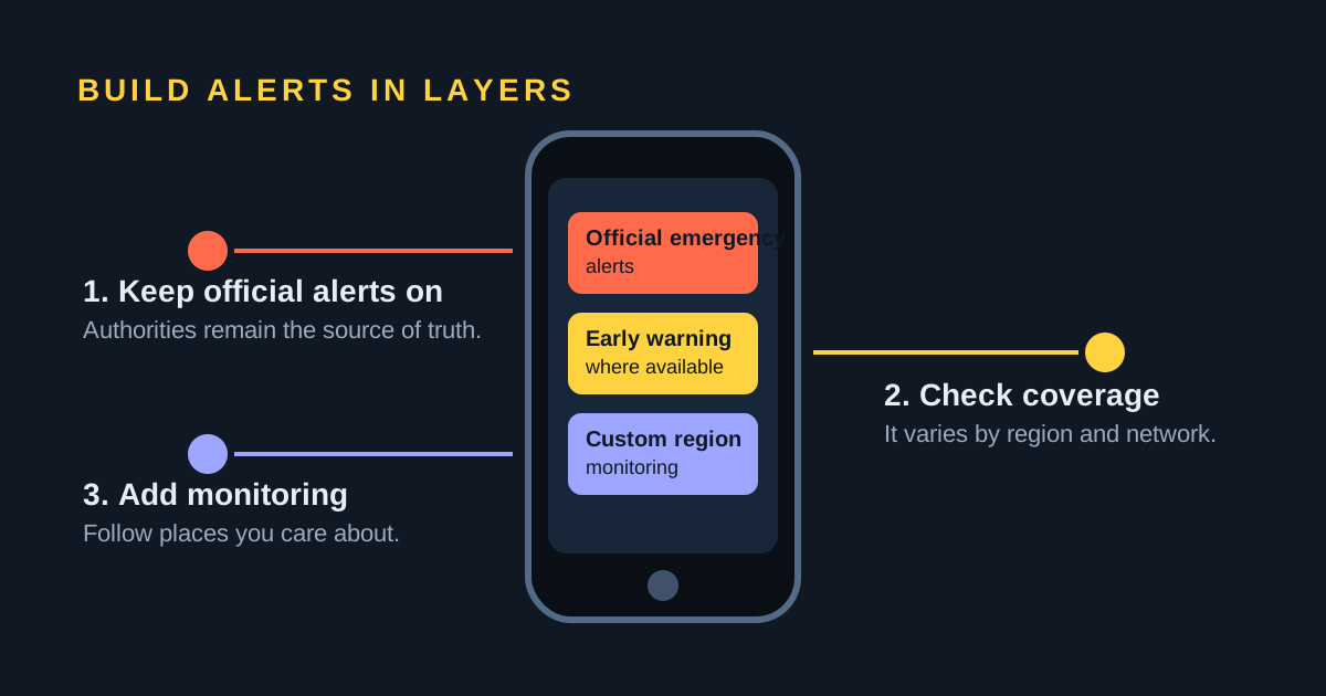
To be explicit: SeismoWatch is a post-event notification service and cannot beat the shaking. It is not an early-warning or life-safety system, and it should never be relied on as one. Use the official emergency alerts available where you live, and treat these notifications as an additional monitoring layer on top.
Within that role it does a job the official channels do not: it lets you watch a specific area at a threshold you choose. You can follow today's earthquakes worldwide, review the past seven days, or narrow to a single region such as Taiwan or Chile.
Turning on the alerts you already have
Almost every modern phone can already receive whatever official alerts exist where you are, and on Android it can also receive Google's accelerometer-based alerts. The settings are buried, and they differ by platform, so we keep the step-by-step instructions in two dedicated guides:
- Earthquake alerts on Android — where the earthquake-alerts toggle lives, and how it relates to Wireless Emergency Alerts.
- Earthquake alerts on iPhone and iOS — government alert settings and what iOS does and does not provide.
Do that first. A third-party monitoring app, this one included, belongs on top of those official channels rather than in place of them.
Frequently asked questions
How many seconds of early warning can I expect?
It depends almost entirely on how far you are from the epicenter. The gap between the fast P-wave and the damaging S-wave grows by roughly 1.2 seconds for every 10 km of distance, and a system needs several seconds of that gap to detect, size and deliver the alert. In practice that means little or nothing within a few tens of kilometers, a handful of seconds at around 100 km, and tens of seconds several hundred kilometers away.
Why did I get no warning at all during an earthquake?
The most likely reason is that you were inside the blind zone. The USGS describes a roughly 25 km (15 mile) radius around the epicenter where alerts are not possible, because strong shaking arrives before the alert can be issued and delivered. Other reasons are that no public system covers your area, that the earthquake was below the alerting threshold, or that alerts were switched off on your phone.
Can an app provide early warning where there is no public system?
Partly. Google's Android Earthquake Alerts System uses the accelerometers already inside Android phones to detect shaking where no dense public network exists, and it operates in around 98 countries. An app that only reads a published earthquake catalog, such as SeismoWatch, cannot provide early warning at all, because the catalog entry is created after the earthquake has been detected and located.
Does SeismoWatch provide earthquake early warning?
No. SeismoWatch monitors published earthquake information from the USGS, EMSC and FUNVISIS catalogs and sends matching near-real-time notifications. It is a post-event notification service, not an early-warning or life-safety service.
Sources and further reading
- USGS: earthquake early warning overview
- USGS: the blind zone of earthquake early warning
- USGS ShakeAlert earthquake early-warning system
- MyShake, the ShakeAlert delivery app operated by UC Berkeley
- Japan Meteorological Agency: Earthquake Early Warning
- SASMEX, the Mexican Seismic Alert System
- Central Weather Administration, Taiwan
- Korea Meteorological Administration: Earthquake Early Warning services
- Earthquake Early Warning System in Israel — Towards an Operational Stage (Frontiers in Earth Science)
- Google Crisis Response: Android earthquake alerts
- Accurate locations of felt earthquakes using crowdsource detections (Frontiers in Earth Science)
- EMSC earthquake information and LastQuake
- National Institute for Earth Physics, Romania
- USGS Earthquake Notification Service